


Voting District 102, Noble County, Oklahoma
About
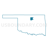
Outline

Summary
| Unique Area Identifier | 654518 |
| Name | Voting District 102 |
| County | Noble County |
| State | Oklahoma |
| Area (square miles) | 103.50 |
| Land Area (square miles) | 103.28 |
| Water Area (square miles) | 0.22 |
| % of Land Area | 99.79 |
| % of Water Area | 0.21 |
| Latitude of the Internal Point | 36.41145840 |
| Longtitude of the Internal Point | -97.34850370 |
Maps


Graphs
Select a template below for downloading or customizing gragh for Voting District 102, Noble County, Oklahoma


Neighbors
Neighoring Voting District (by Name) Neighboring Voting District on the Map
- Voting District 101, Noble County, OK
- Voting District 103, Noble County, OK
- Voting District 105, Noble County, OK
- Voting District 106, Garfield County, OK
- Voting District 109, Garfield County, OK
- Voting District 210, Garfield County, OK
- Voting District 301, Noble County, OK
- Voting District 303, Noble County, OK
- Voting District 304, Noble County, OK
- Voting District 307, Noble County, OK
Top 10 Neighboring County Subdivision (by Population) Neighboring County Subdivision on the Map
- Perry CCD, Noble County, OK (7,753)
- South Garfield CCD, Garfield County, OK (3,851)
- North Garfield CCD, Garfield County, OK (3,398)
- East Noble CCD, Noble County, OK (3,084)
- Billings CCD, Noble County, OK (724)
Top 10 Neighboring Unified School District (by Population) Neighboring Unified School District on the Map
- Perry Public Schools, OK (7,153)
- Garber Public Schools, OK (1,788)
- Covington-Douglas Schools, OK (1,541)
- Frontier Public Schools, OK (1,401)
- Billings Public Schools, OK (815)
Top 10 Neighboring State Legislative District Lower Chamber (by Population) Neighboring State Legislative District Lower Chamber on the Map
Top 10 Neighboring State Legislative District Upper Chamber (by Population) Neighboring State Legislative District Upper Chamber on the Map
Top 10 Neighboring 111th Congressional District (by Population) Neighboring 111th Congressional District on the Map
Top 10 Neighboring Census Tract (by Population) Neighboring Census Tract on the Map
- Census Tract 12, Garfield County, OK (3,851)
- Census Tract 11, Garfield County, OK (3,398)
- Census Tract 9566, Noble County, OK (3,084)
- Census Tract 9571, Noble County, OK (2,860)
Top 10 Neighboring 5-Digit ZIP Code Tabulation Area (by Population) Neighboring 5-Digit ZIP Code Tabulation Area on the Map
- 73077, OK (7,135)
- 73738, OK (1,134)
- 74651, OK (743)
- 73730, OK (734)
- 74630, OK (702)
- 74644, OK (478)
- 73757, OK (178)